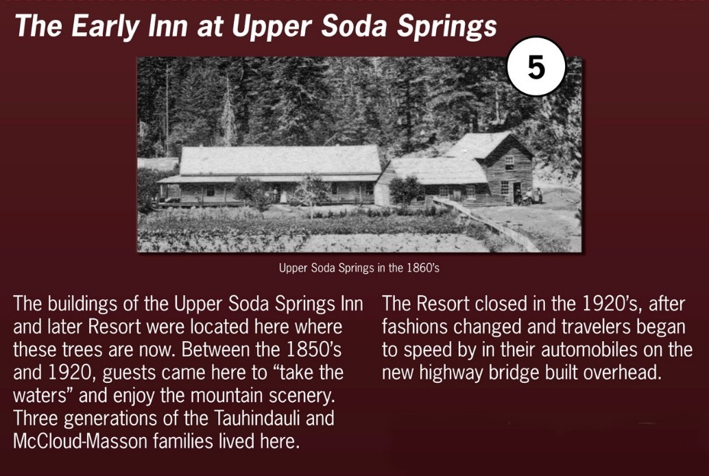
Self-Guided Tour Sign #4 - Upper Soda Springs

Water from snowmelt on Mount Shasta seeps underground, and travels underground for miles until it comes to the surface as springs along the Sacramento River. One of the places where water from Mount Shasta comes to the surface is at Upper Soda Springs. The “soda water” here has a special refreshing taste and bubbliness that many have found enjoyable since the mid-1850’s. Sadly, the springs today are not open to the public.
For more detailed information, continue reading below.
What does that mean -- “soda springs”?
The Sacramento River Canyon is dotted with “soda springs” … springs where the water coming from underground is flavored with minerals, giving each spring its own unique taste and sometimes bubbly effervescence! Nearby examples include Ney Springs, Oxone Springs, and Cave Springs to the north, and Lower Soda Springs to the south.
What does “soda water” taste like?
The water from each spring has its own special flavor that the water gets from its own minerals. The soda water here at Upper Soda Springs, for example, has a mild tangy flavor and slight bubbles; the water at Ney Springs by comparison has a very strong flavor and has no effervescence. The soda water here is especially good for lemonade, or for being served with the mint that grows here. Beginning in the 1860’s and 1870’s, people began to come from all over the world to drink Upper Soda Springs soda water and the water at other nearby soda springs.
Is all the spring water along the Sacramento River near here “soda water”?
Sometimes the water from springs near here is very lightly flavored—with just trace amounts of minerals. Not far north of here are Mossbrae Springs and Shasta Springs, both of which have very lightly flavored water. The water from Mossbrae Springs is so delicious, in fact, that it is the source of the tap water for the city of Dunsmuir, and is the reason why Dunsmuir’s city motto is “Home of the Best Water on Earth”. Water from Shasta Springs was the centerpiece of the Shasta Springs Resort, which was located just to the north of the Dunsmuir city limits (next to Hedge Creek Falls). Shasta Springs Resort was in operation as a resort from the late 1880’s to the 1920’s.
Where does “soda water” come from?
How soda water arrives here and acquires its special and unique flavors is an interesting story involving lava flows from Mount Shasta to the north, dating back millions of years.

Beginning perhaps millions of years ago, an earlier version of the Sacramento River started small

Over many years, the young river cut and created an original deep river canyon where you are walking now.

Then, about 450,000 years ago, there was a huge eruption of very liquid lava from the foothills of Mount Shasta—much like today’s very fluid lava flows in Hawaii. This huge amount of lava flowed south from Shasta’s foothills and filled the Sacramento River Canyon here to a depth of fifty to seventy-five feet. Imagine that where you are standing now was underneath more than fifty feet of molten flowing lava! This lava flow continued south along the canyon for another forty miles or so, reaching nearly to today’s Lake Shasta.

The lava eventually cooled and hardened, filling the original Sacramento River Canyon.
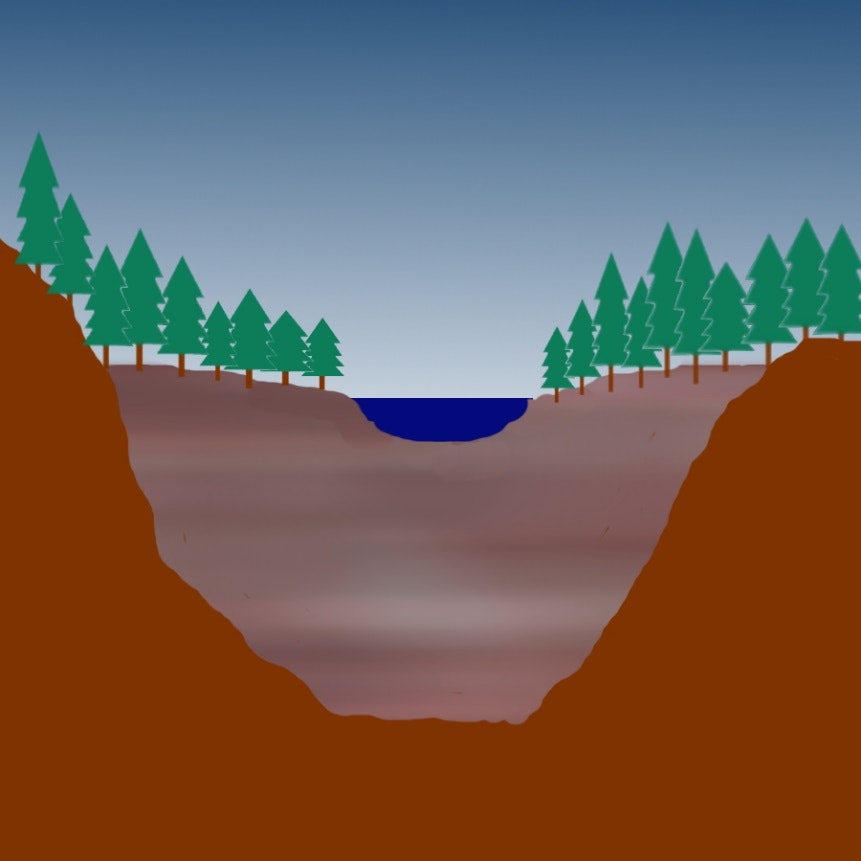
When the lava was finally cool enough, water from north of here began to flow again along the top of the new lava—following the path through the mountains of the original river.
During the most recent hundreds of thousands of years, this new Sacramento River cut its way down through the hardened lava, creating the Sacramento River and its canyon that you see around you today. The remains of this cooled and hardened lava can still be seen from the Park—for example, underneath the bridges that cross over the Park, as well as at hundreds of places along the river from Lake Siskiyou in the north all the way nearly to Lake Shasta in the south.

That original river had many small creeks and streams that came down the hillsides and fed into the river. Some of this water came from springs with water that started on Mount Shasta and which trickled down through miles of underground lava—to reach the surface near the river as a spring.
When the big lava flow happened 450,000 years ago, these old springs were buried under the new lava. Eventually, the water from these springs worked their way through the new layer of cooled and hardened lava. When the spring water broke through to the surface again, this time it had added new minerals and flavors from the new lava!
The result of all these hundreds of thousands of years of activity is the wonderfully flavored and slightly bubbly water of Upper Soda Springs!